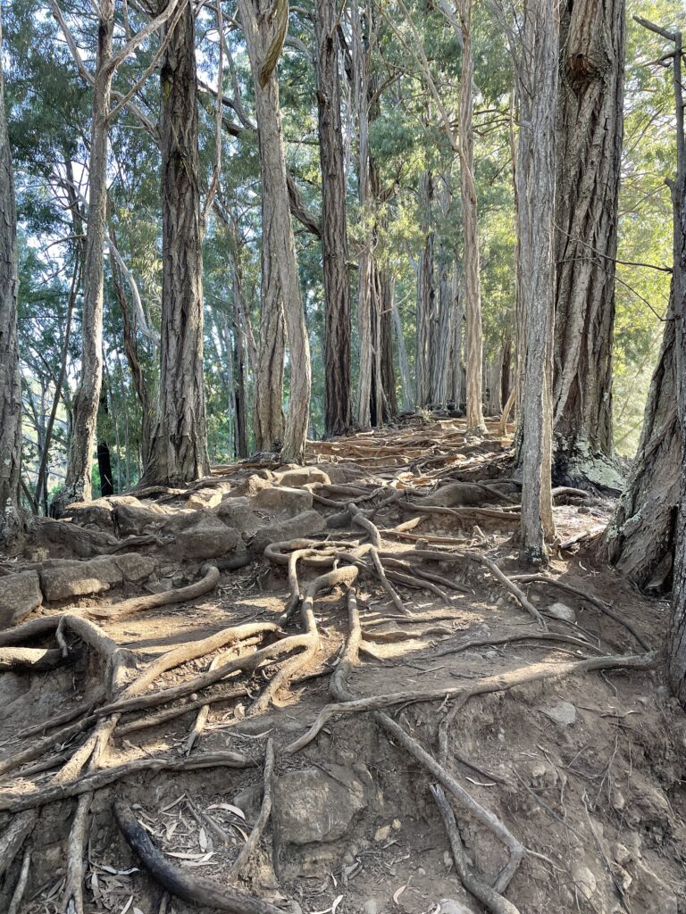
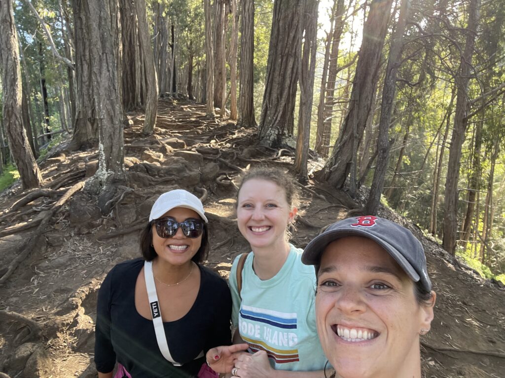
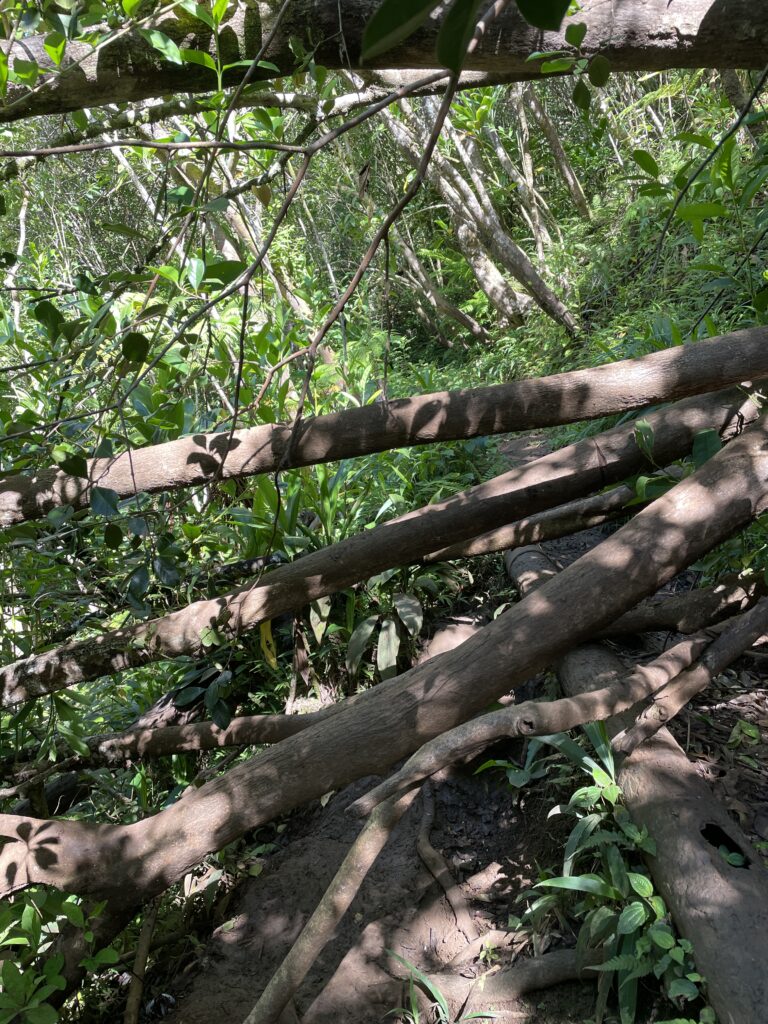
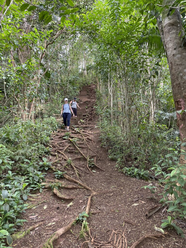
Makiki Valley Loop Trail is in the middle of Tantalus, a protected forested area of Oahu. After all the hiking I’ve been doing, I thought this would be a walk in the park, but it was actually deceptively a bit harder. I didn’t realize it was rated moderate, it was 1000 ft gain but I didn’t look at the map hard enough to realize it’s all in the first mile or so, phew! This is the maze of roots we navigated working our way up. There were beautiful views of the valley on both sides.
The two other spouses who went happened to be sub spouses, it was great bonding!
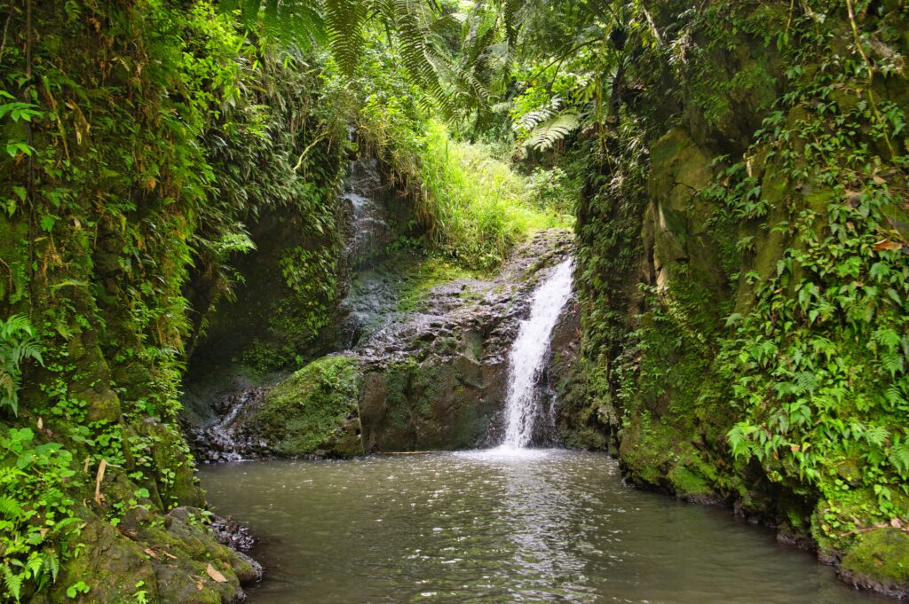
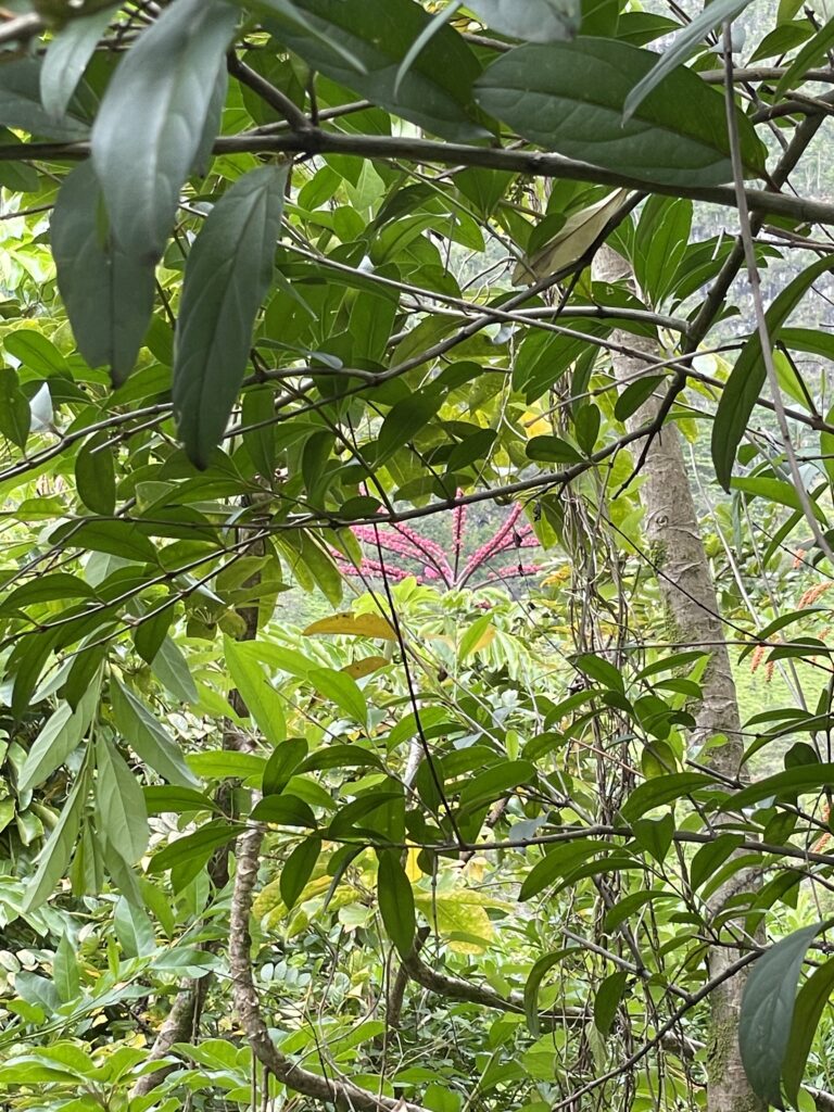
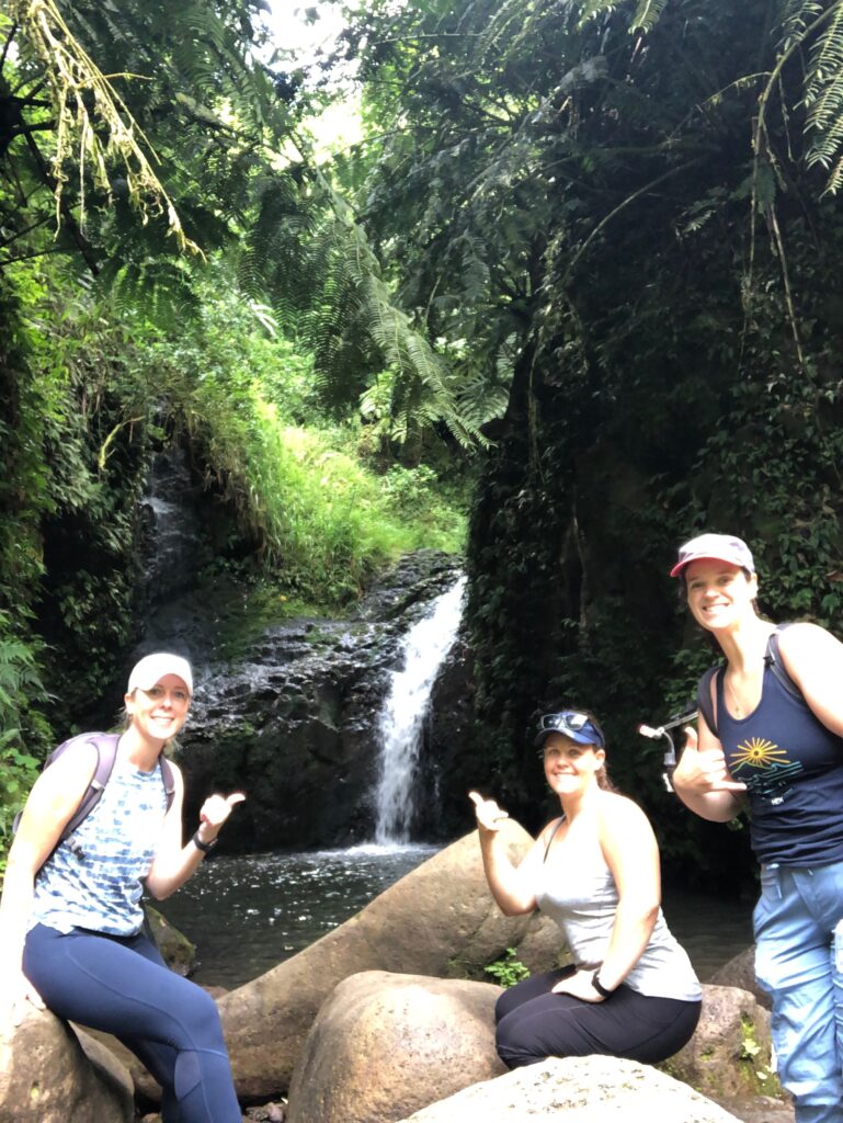
There’s a secret extension to a waterfall and I was happy we found it and came across it. It was so beautiful.
It ended up taking us a little over two hours with time built in just to enjoy the moment, 4 miles, and 946ft elevation gain. There was a decently big parking lot, maybe enough for 25 cars, but it’s a really popular area and I think it was filled by the time we left. I’m glad we got there early. Still suffering from a low-ish turnout on hikes. But it’s better than the zero I had over the winter!
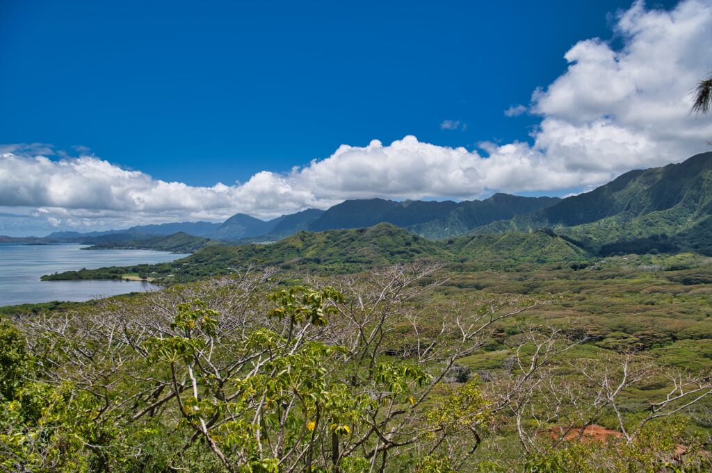
Pu’u Ohulehule is a hike a bit up the coast from where I live. It’s also known by a geographical feature called “Pride Rock” for the same reasons you can assume. Unfortunately, there was a 40ft stretch of 50% to near 50% grade trail that was very loose gravel. I climbed about halfway up and decided to freak out about trying to get back down. Slowly but surely and thanks to some footing help from my friend I made it.
I didn’t get to Pride Rock, but I did get a couple great peak-a-boo views along the way.
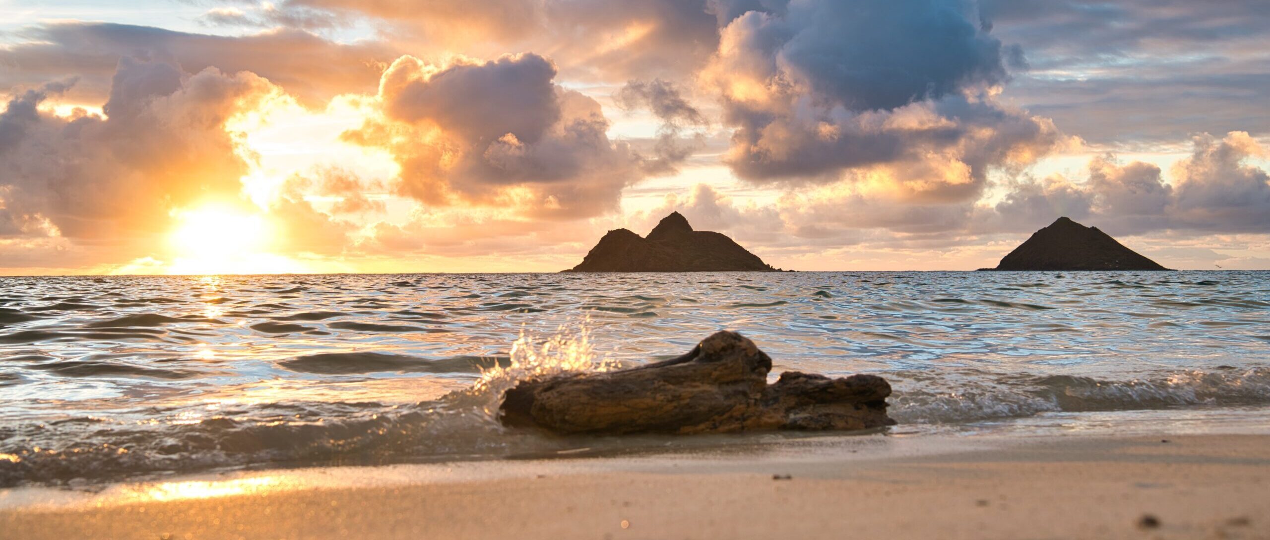
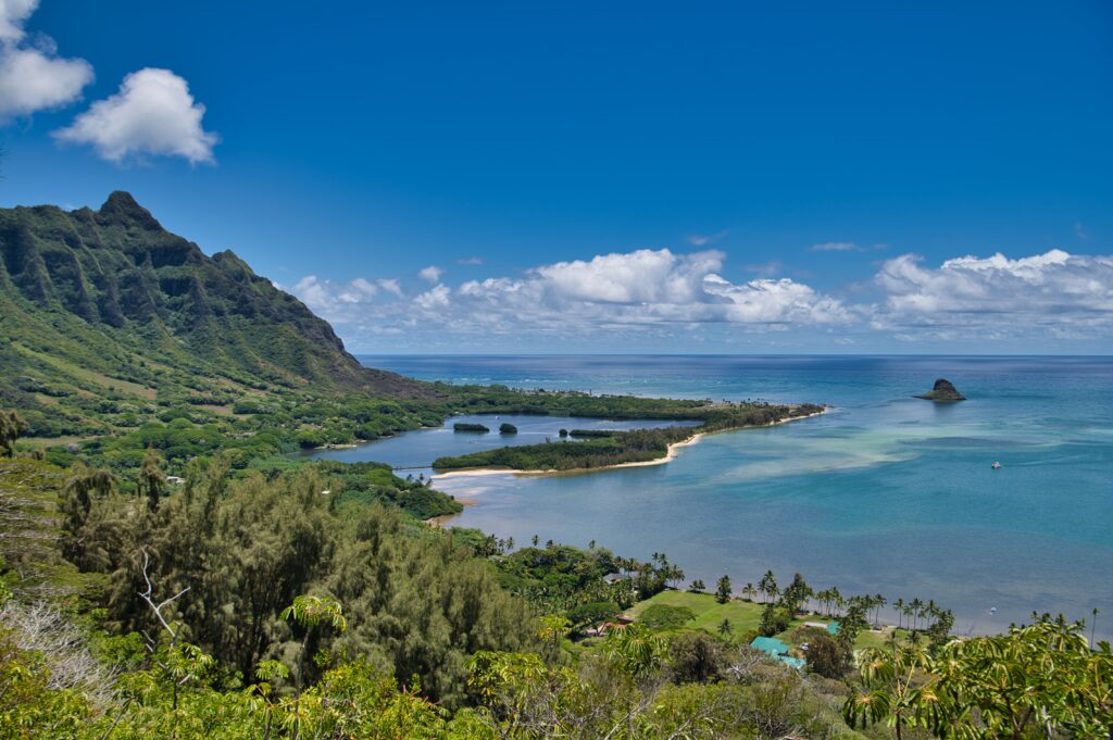
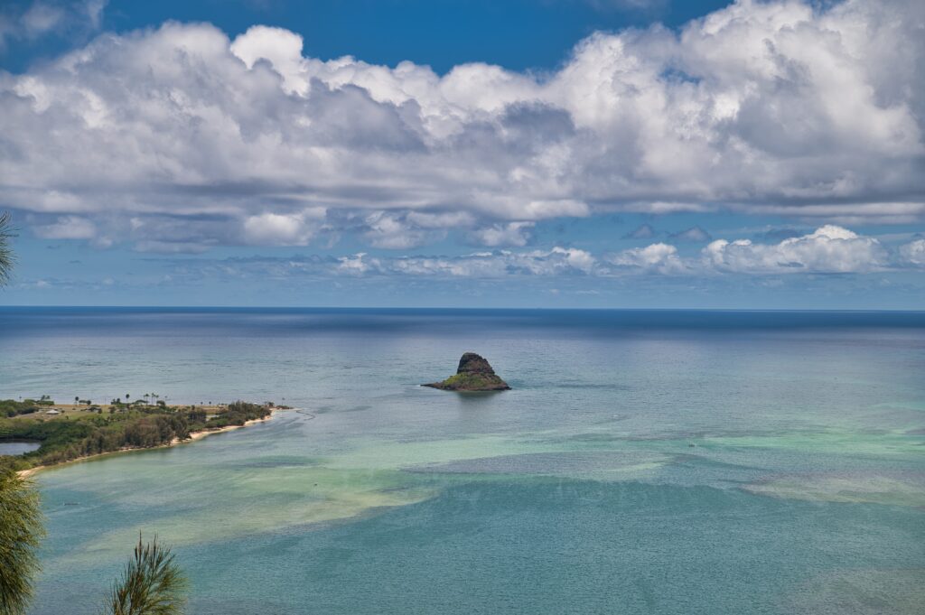
You might recognize the island to the right – it’s Mokoli’i, Chinaman’s hat, the same one we paddled to recently. This next pic is looking back toward where I live.
I think I could do it if I had put my spikes on, but by the time I was down no part of me wanted to put my spikes on to try again.
This marks my fourth DNF hike. Ka’au crater, Koko head stairs, Chinaman’s hat the other three. I’ve never not finished hikes before, unless you counted the one from Yosemite which I didn’t finish due to health concerns.
The new friend that came with me, Lisa, was incredibly understanding and didn’t make me feel bad at all. It was our first time hiking together, so I felt like I let her down, but promised we could go and do one I’ve been successful at.
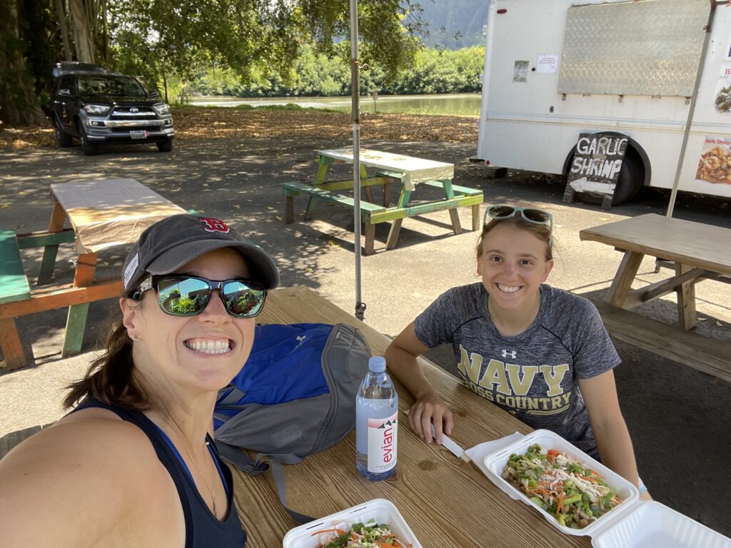
After, we hit up this roadside Thai place and I had DELCIOUS Pad Thai. It was only $13 and I split it into three meals the portion was so huge.
My goal for the next year is to try to be more spontaneous and stop and places like this. They are everywhere in Hawaii.
Anyway, continuing to be frustrated that my did not finish list is growing… but oh well.
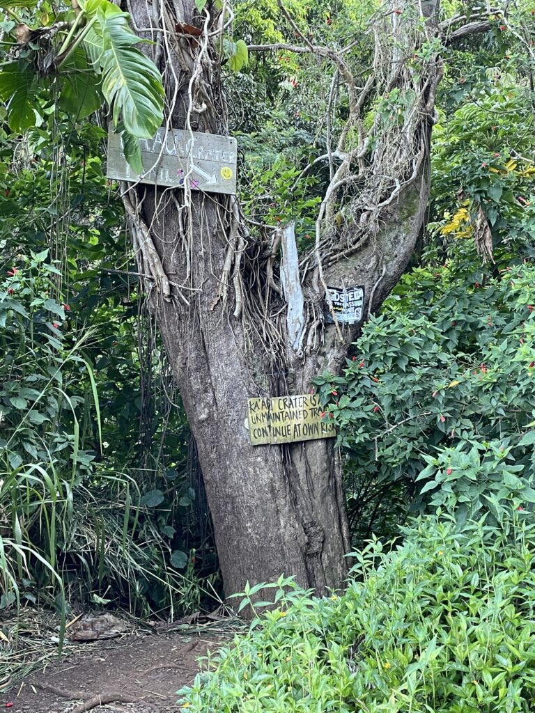
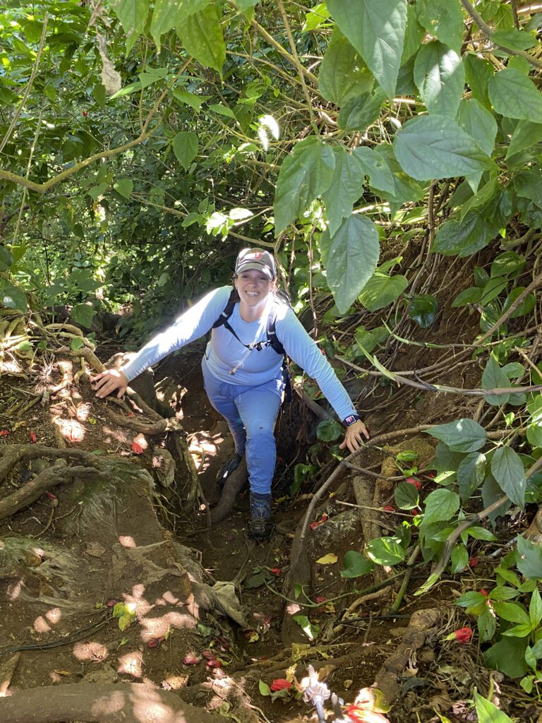
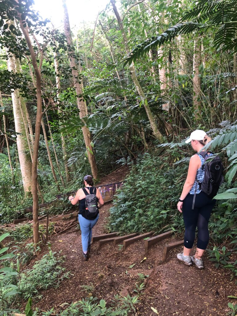
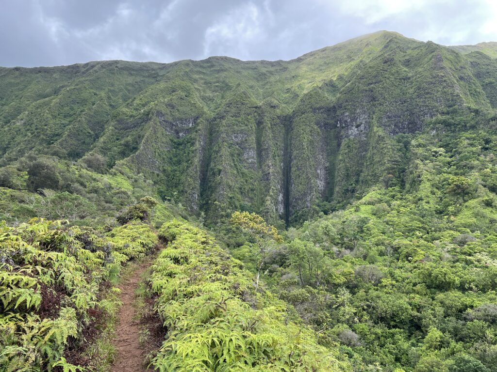
This is a hike with no victory story at the end, no grand climax, no “I pushed through and conquered”. It’s a very, very, difficult hike and I knew that going in, but I didn’t realize HOW taxing it would be. I’m going to open with a picture of the one, of many, technical challenges we faced along the way. We had to get through this jungle gym of a fallen tree.
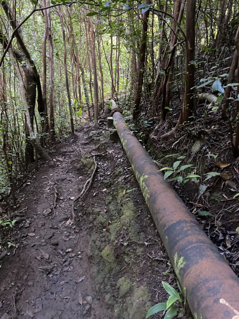
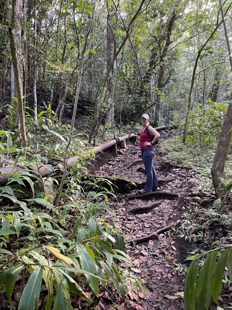
This hike, when accomplished, has it all – waterfalls, views, and a hidden volcanic crater – by journeying in a loop. However, it’s also very difficult, and my goal this time was just to do an out and back to the first waterfall. Well, we got about 2.5 miles in, and I had tripped over myself more times than I could count (this is irregular for me, it was a combo of my defective spikes and PMSing). I didn’t want to keep chancing it. It felt like every 10ft there was some technical part, and we finally got to a spot where there was very little actual path, and I couldn’t do one more thing. I wish I took a picture, but essentially we follow this pipe up, and at one point that path that is well defined here, essentially narrows to next to nothing.
Some day I’ll go the opposite direction and hope I make it to the crater – I am ok with missing out on a couple waterfalls, but I really want to see the hidden crater.
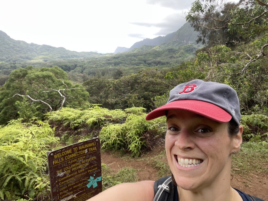
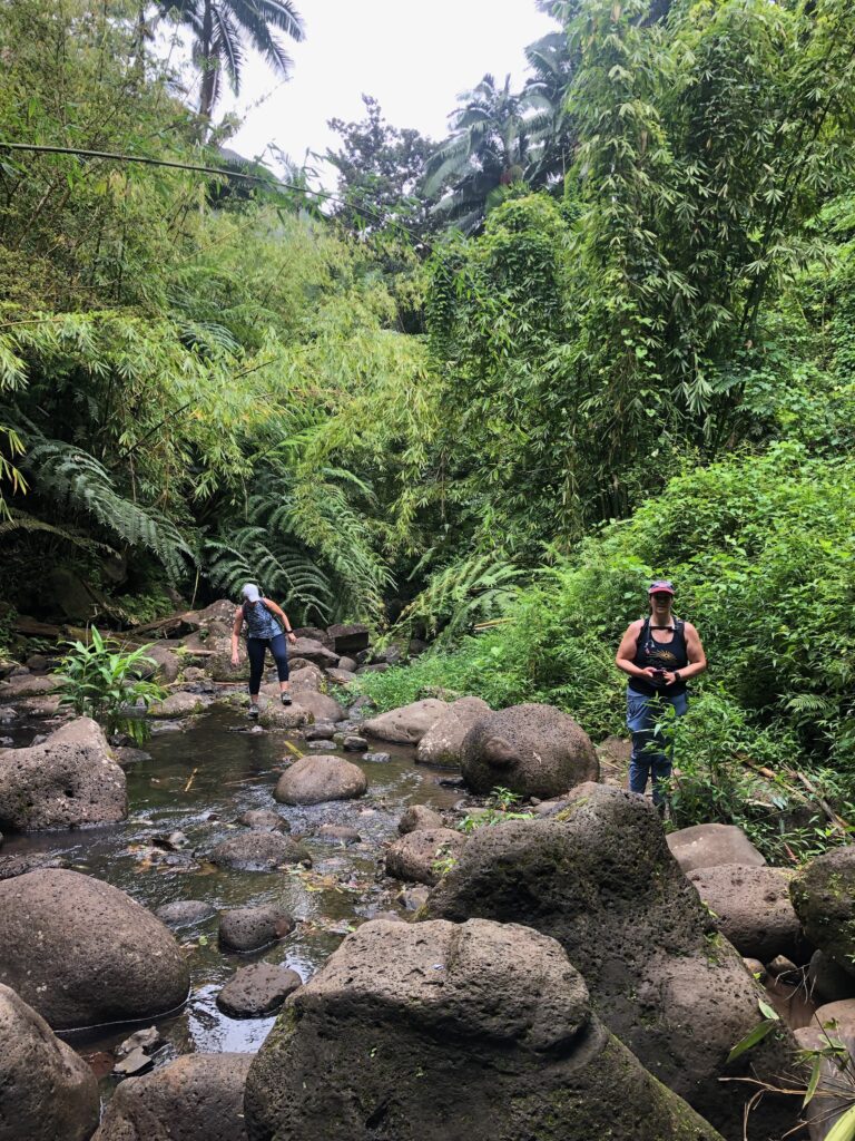
Maunawili Falls is a waterfall that is so popular among tourists, one hiking access route was closed shortly after we arrived in Hawaii in order for trail restoration to occur. This leaves a couple other, much longer, options to get to the waterfall- the one we took was a 6.5 mile total hike. A couple friends had been eager to go on it, so I asked them to choose a date so we could plan to go together with KOSC. Well, they both ended up needing to bail due to life circumstances, and in fact only 3/14 registrants ended up committing. It’s a pretty typical problem with my hikes. Nonetheless, we trekked and had a great time!
The parking for it is on the “hairpin” turn on Pali highway- it is a really small parking lot and there were threats of both tickets and broken glass. When we arrived, there was a ton of broken glass on the ground. Thankfully, even though we were out on the hike for four hours, my car was safe and sound.
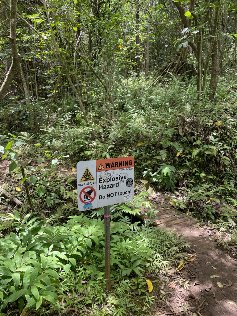
The trail starts pretty ominously with this non descript warning… these signs are around Hawaii due to unexploded bombs I believe. Strange they wouldn’t take care of it but here we are.
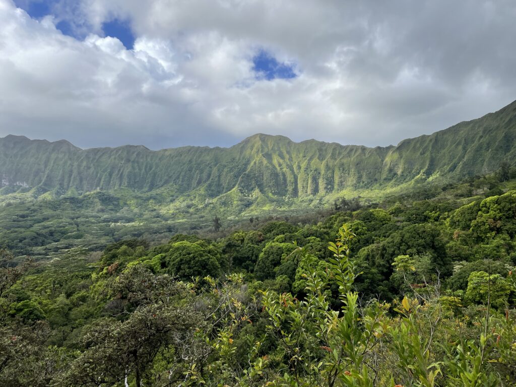
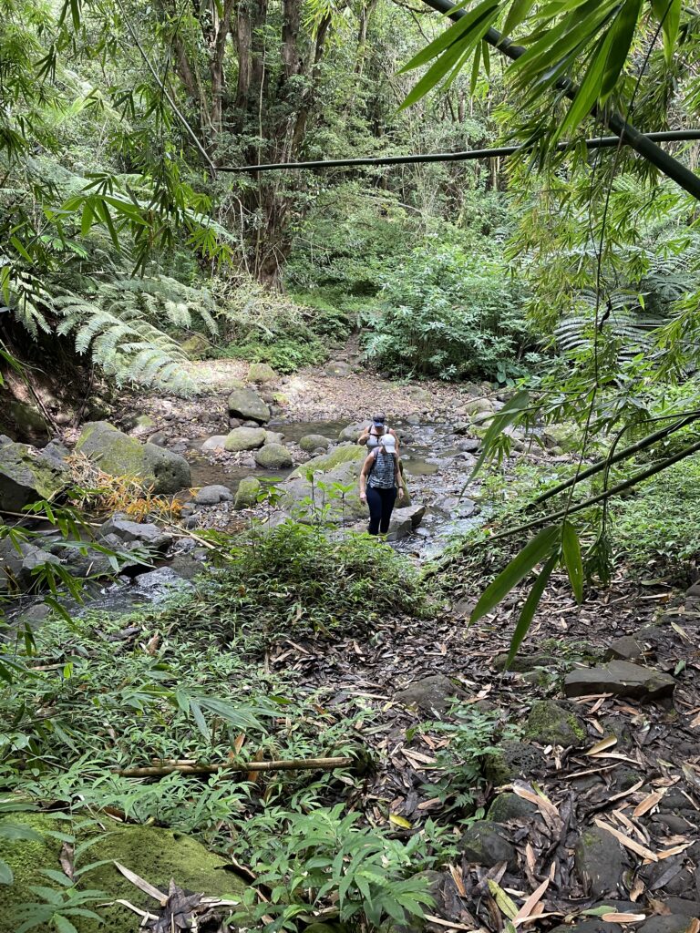
Essentially you start with hiking the inside of this mountain range and have some amazing peak a boo views in the beginning. Eventually, we take a left and head down into this lower forested area to get to the waterfall…about 2.75 miles in.
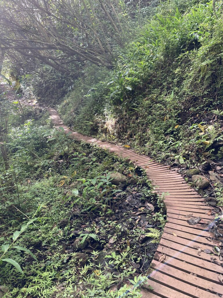
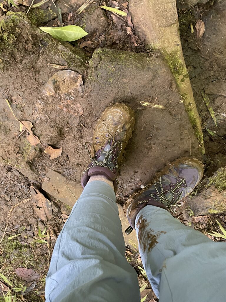
The trail is a mix of about everything, from board walk to rock to streams to lengthy mud puddles. So many natural flowers along the way.
I took a chance on a puddle and unfortunately I sunk right in. Some are pretty dense and you stay on top.
This is where we took a left to get to the falls.
We made our way down some stairs cautiously and found the stream, we’re getting close!
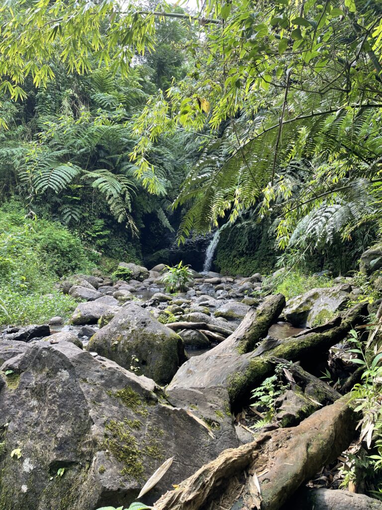
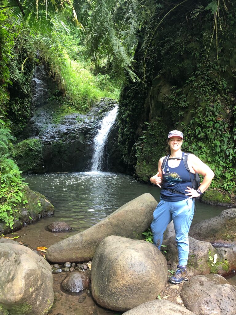
Finally, the falls!
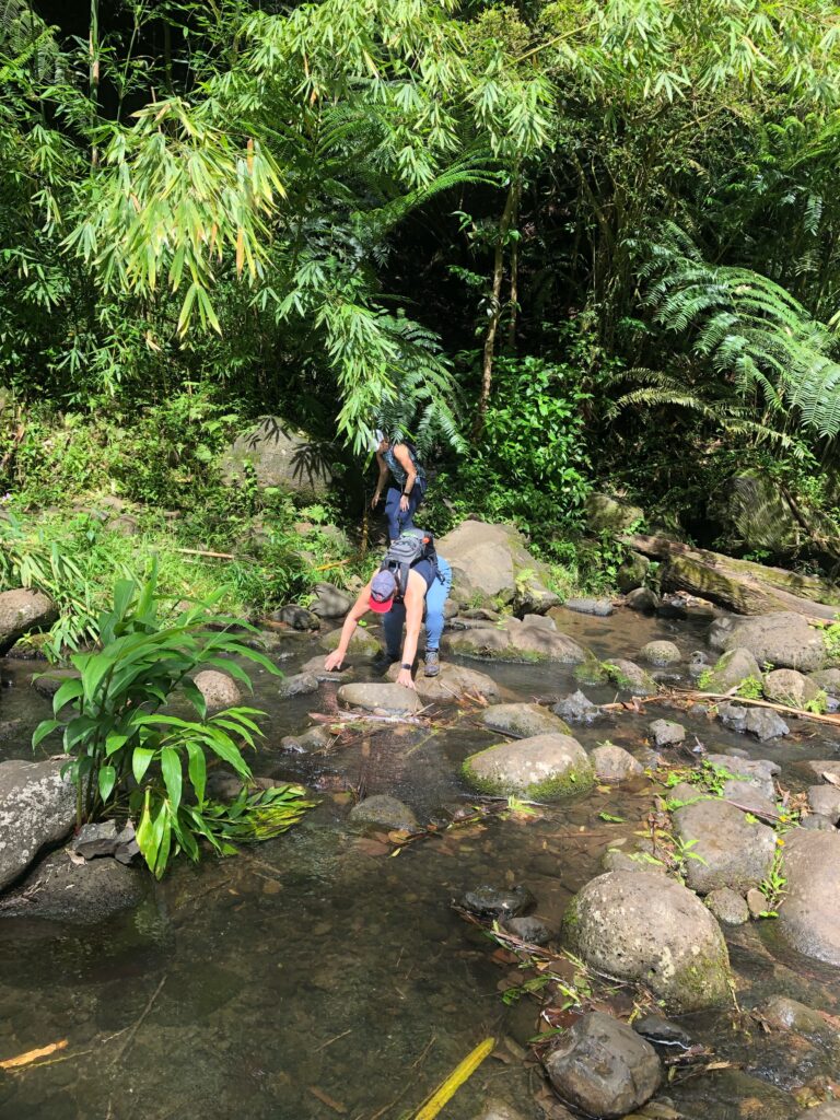
The path was blocked by a fallen tree, so we definitely needed to walk up the stream. This part was tricky, and one of my boots ended up filled with water. Thankfully Kaylynn was there to push us all the way because I had about had it with the stream and slippery rocks. I would DEFINITELY take my water shoes next time and changed quickly. Would’ve made a world of difference for this last section.
Now we turn around and climb our way back out. It was helpful to have beautiful views along the way.
Thankful for these ladies to have joined me. I would do this hike again if I gave it some time to dry out. I will also confess that this was a stressful day – Brian left the morning of this hike. His boat was departing later that afternoon and I wanted to go home, shower, and make it to pearl to see. So I was eager to go quickly. I think I’d like to go back under better conditions, with better shoes, and at a slower pace.
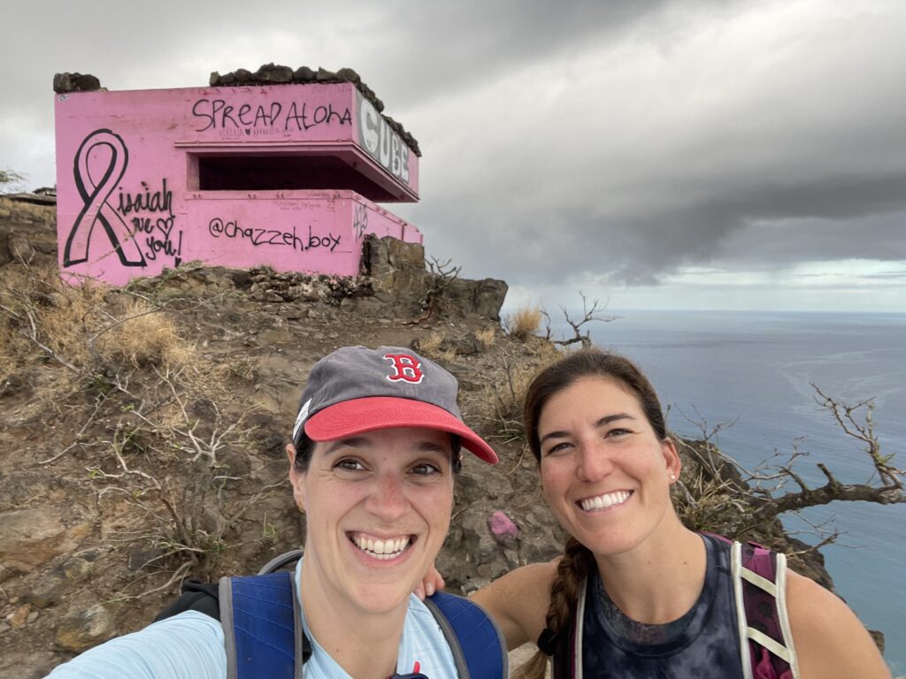
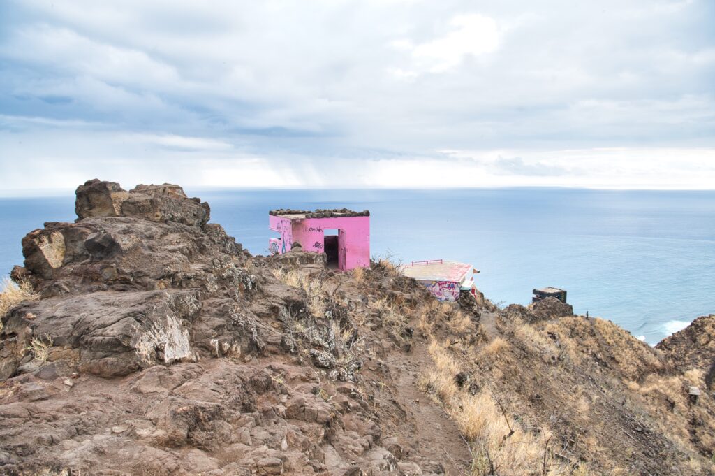
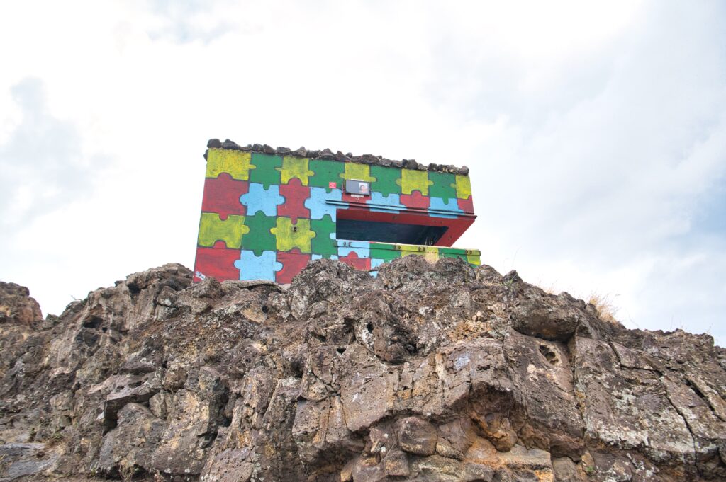
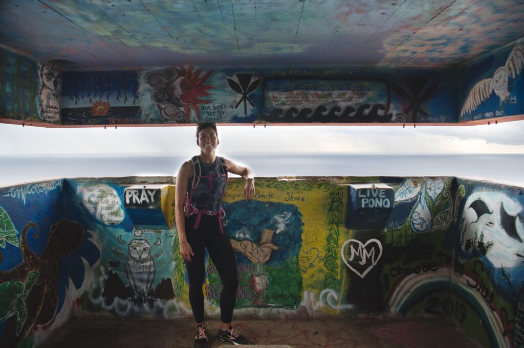
Brian forgot his lunch I so lovingly packed him the night before… so I was trying to find a reason to head that way after work (he was on duty, too). I asked Jess if she finally wanted to get the Pink Pillbox in, which is just a bit North of base, and she said yes! It’s over an hour from where we live so it’s a “hike” to get there in the first place. We headed to bring Brian dinner and then to the pillboxes. This set of Pillboxes is known for its art (and one for being pink).
I really loved this hike and would frequent it more if it were closer. I wish we had gone on a sunnier day to really experience the beauty of the scenery, but the hike itself was a workout but not too much and the artwork was a lot of fun. Also, the parking was a huge plus… PLENTY of street parking.
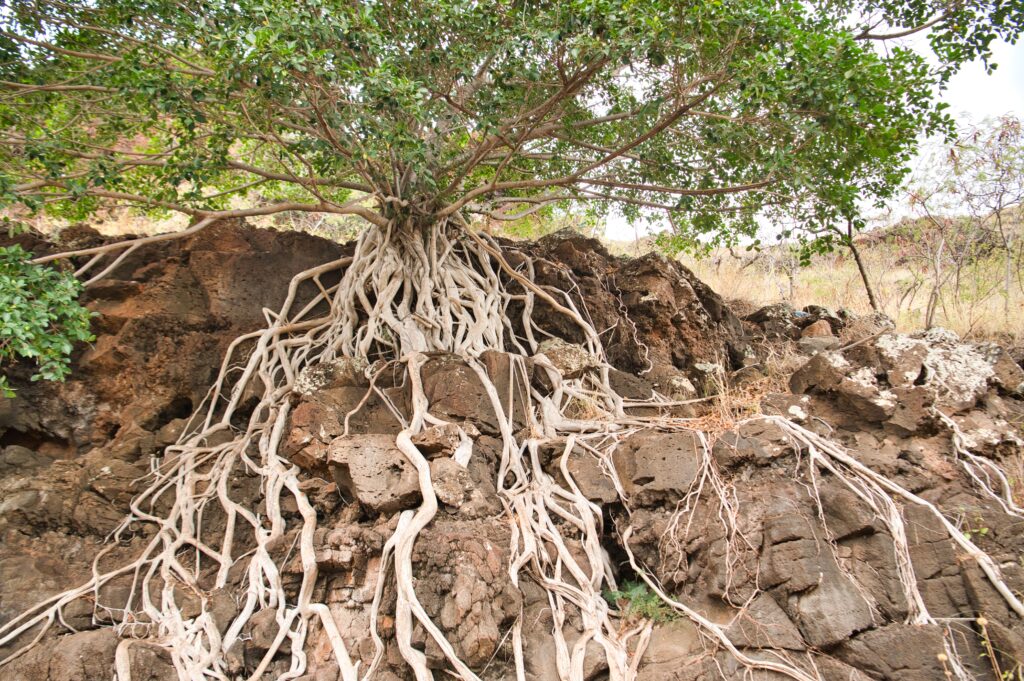
There was this gorgeous tree along the way and there wasn’t a lot of scrambling or scary parts. Mostly gravel. I will say we caught a little rain at the tail end which started to make things slippery.
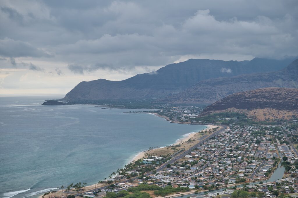
This next view is looking up toward Ka’ena point where we went whale watching and hiking.
Another one in the books for Jess and I! This nearly completes the list of highly popular hikes that everyone on Oahu talks about. I’m glad we finally got to it!
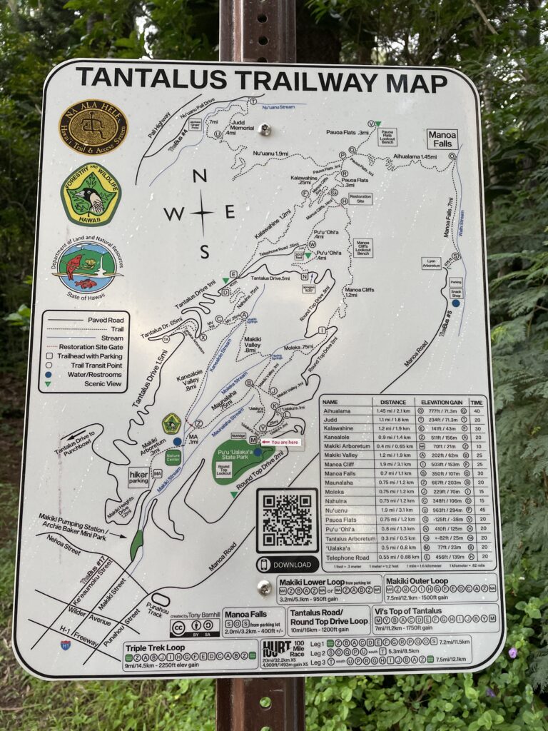
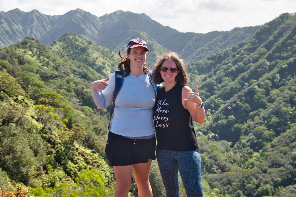
Tantalus is a set of trails in the back woods of Honolulu. Surprisingly I haven’t checked them out until I was over in the area the other day and I had Jess meet me to explore. We could only get a couple miles in, but it was a great exploration adventure!
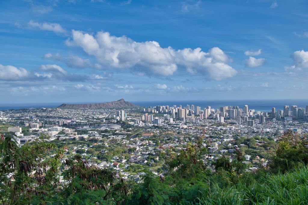
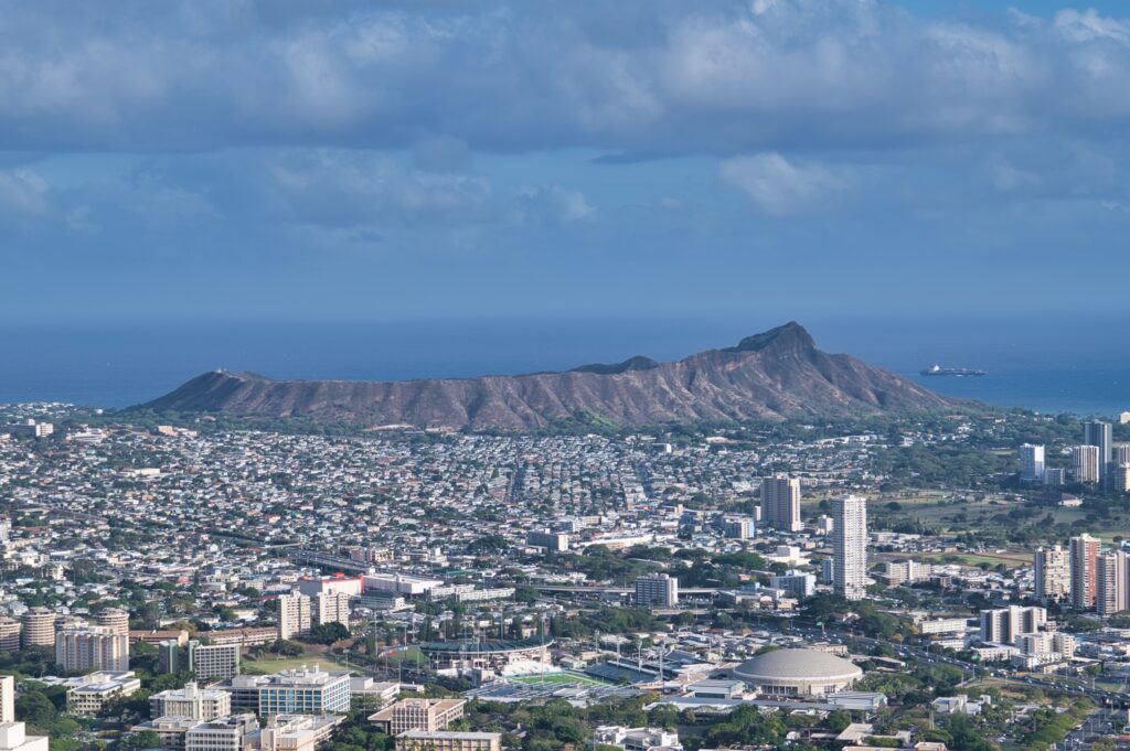
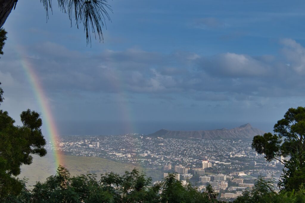
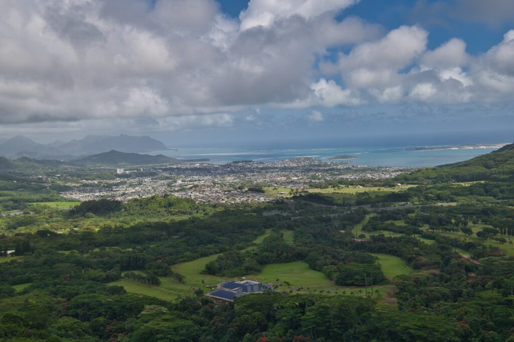
First of all, you drive up these switchbacks and end up at a lookout with an amazing view of Honolulu and Diamondhead. It’s a little paved path out to this lawn area and overlook.
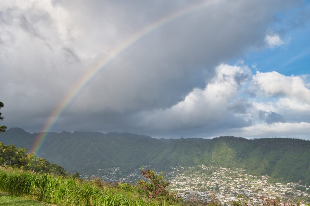
It happened to be raining so I got a couple epic rainbows
We had just enough time to fit in a small loop so we took Uala’ka and nearly got lost a bunch of times because there a few off the record trails. We got two miles in before the sunset though.
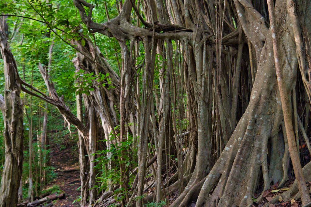
I didn’t want to spend too much time lallygagging but here’s a really beautiful tree. Pictures never do these justice.
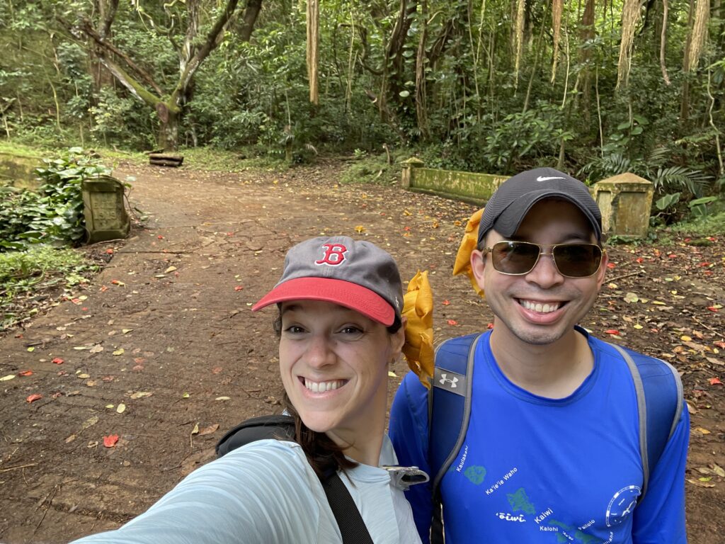
The trailhead to Likeke falls is at the same parking lot as Old Pali. I did this before with Jess on my birthday. It’s a wicked quick hike “usually done in 24 mins” according tom AllTrails. So we knocked it out after we finished Old Pali. Not much to say about it, it was certainly busier (typical for a Saturday) which didn’t make for much fun when we got there, but we came, we saw and had another adventure. It was pretty muddy and slippery today.
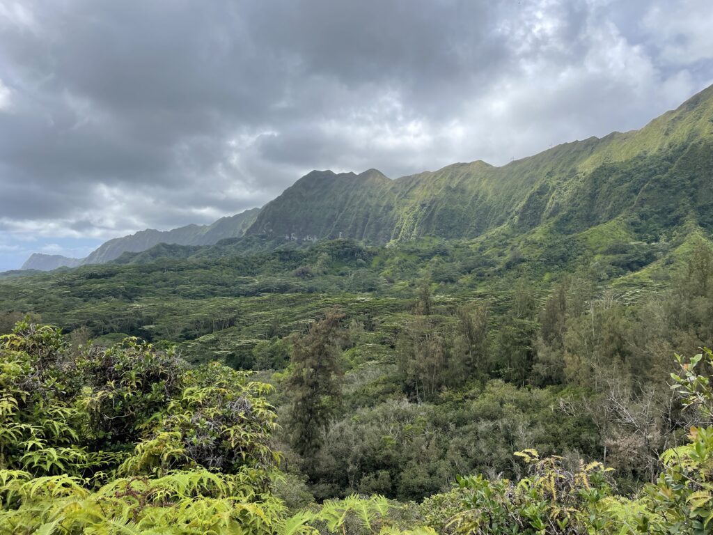
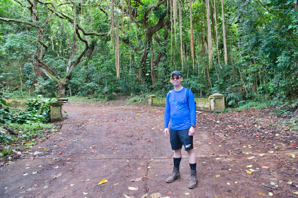
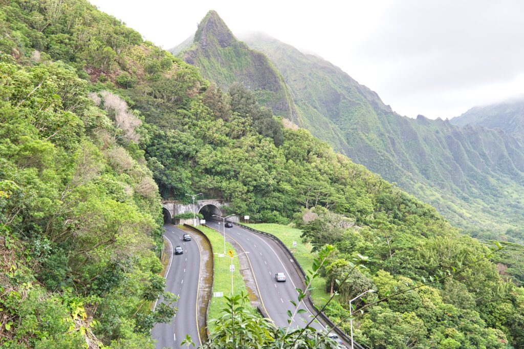
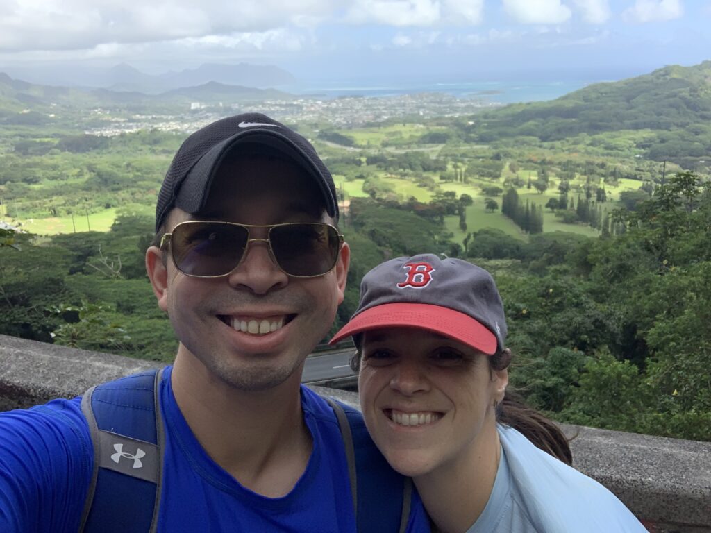
Brian and I had a morning to go adventuring and our plan was to tackle the Koko head stairs together. However it’s been rainy so we decided it wasn’t the best idea. It occurred to me the night before that I haven’t brought him to the Old Pali Rd. hike and I haven’t done the part I set out to do with KOSC; take it all the way to the Pali Lookout.
The parking doesn’t open until 8 am anyway, so we had a leisurely morning and got breakfast and headed out around 9am. The parking attendant told us he wasn’t accepting CCs…. whoops… thankfully Brian had cash and we managed to scrounge together $5, which he accepted even though it cost $10. Yay!
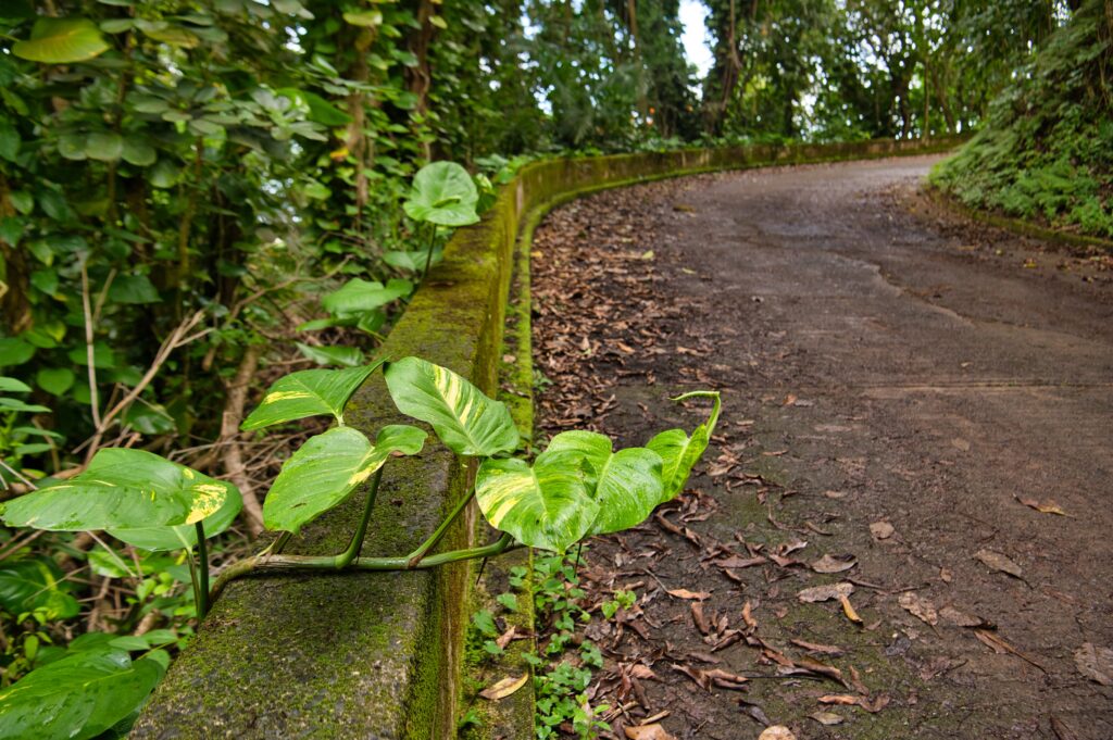
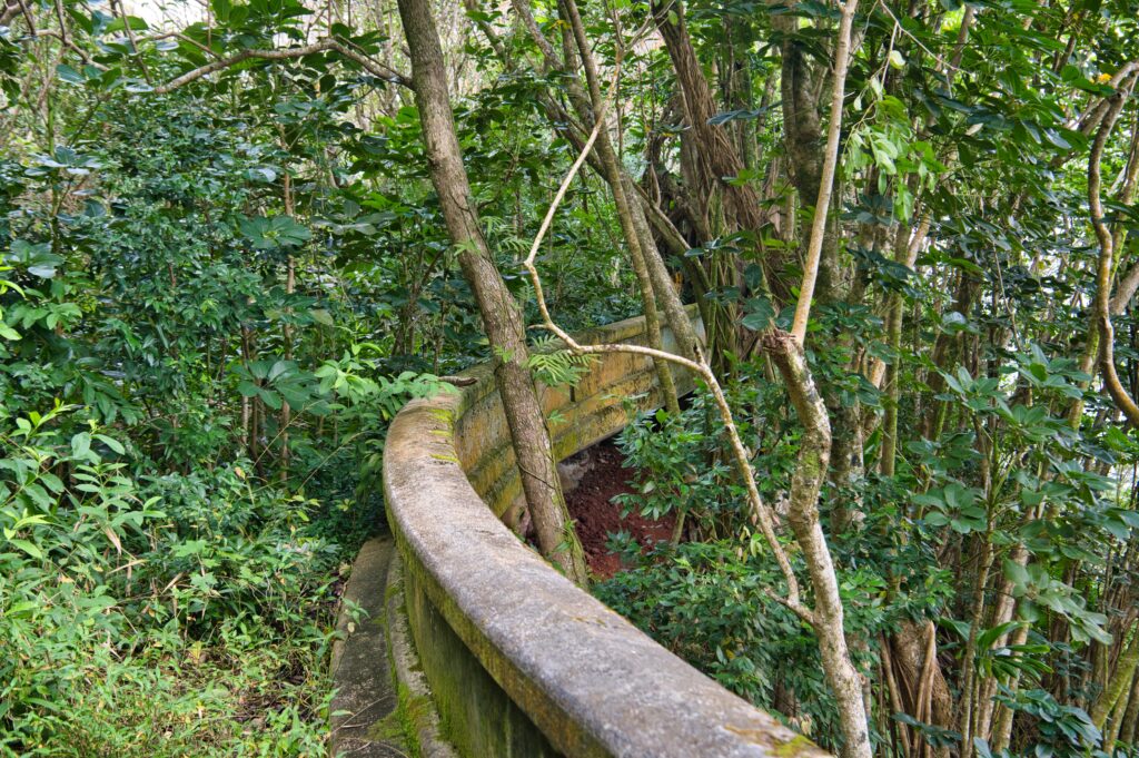
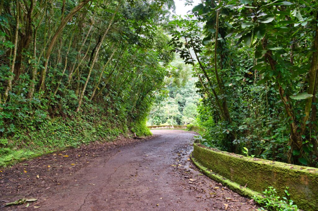
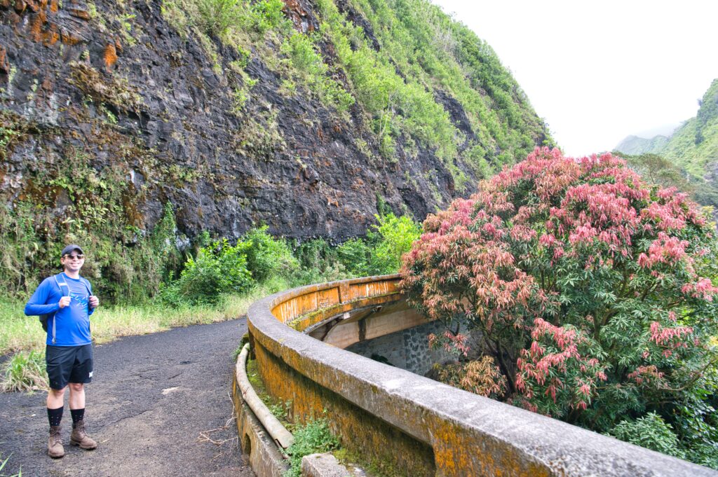
Anyway, we set out and Brian was in awe, just as I was the first time, although I was way more appreciative this time without having to worry about so many people. We meandered our way up the winding “road”. It is really an abandoned highway being taken over by a jungle and is as cool as you’d expect.
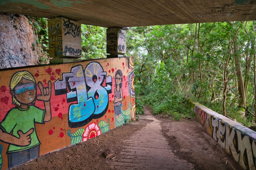
We got to the real pali highway, where you have to duck under it, and then continued on up toward the lookout.
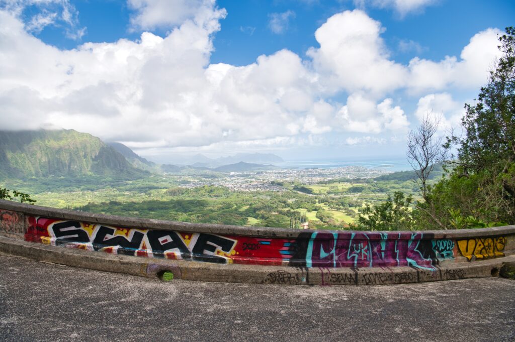
Almost the entire way is paved, which was a significant difference to my last experience going to the other lookout which was very muddy and slippery. This made for a much more enjoyable experience! And much better views!
We found these giant yellow flowers and Brian humored me when a second one fell serendipitously in front of us and I put it in his hat.
It took us an hour and a half, 3.3 miles and 850ft elevation in total. It was awesome! I’m so glad I remembered to introduce this hike to Brian and that we had a very pleasurable experience this time.
Hiking in Hawaii is a very unique experience. I suppose it could be compared to somewhere like Fiji if I had to guess… but it’s very different from hiking in New England and I’d go as far as to say most of CONUS. You can never be too sure about the “officialness” of a hike, or to put it plainly “am I allowed on this part of land”. I’m not fully clear on why this is, but I think it has a lot to do with the history of Hawaiians and the respect of ‘aina (land). There seems to be this back and forth between the cultural “everyone has access to all land” and “yes that’s true but we started this thing called private property” and “there are certain ancient places that shouldn’t be disturbed”. Then you throw in money and politics and it’s one big pot of “Is this hike allowed or no?” So it’s all just kinda weird. The best example of this is the controversial stairway to heaven hike.
I have done hikes that are labeled “private” on All Trails. It’s labeled Private because it’s inside the military base. So, really, is it all that private?
All this to give me justification for trying another “Private” hike called Deadman’s catwalk. It’s at the top of a ridge accessible by an access road. I’ve had a lot of requests to do this hike for KOSC, but I had real reservations about it. So I thought I’d ask Jess to go check it out with me first.
Well, when we get there, there’s a HUGE sign saying NO TRESPASSING and HIKING NOT ALLOWED and a big locked gate. This is different than other “private hikes” that have a dingy fence and small do not enter sign. It makes Jess and I uncomfortable, but friends of ours have done it so… we try. As we get closer, a car enters, and we kinda stay back on the sidewalk for a bit.
After getting over the fence, we start walking up, to see a sign that says HIKERS WILL BE PROSECUTED. Gulp. We try to ignore it. Then we get higher and a truck drives by. Jess kinda runs to hide, I think to myself there’s no way I’m not being seen… and the truck drives by without saying anything.
Finally, we get to another gate, and it has huge signs again. It was just the final straw… I wasn’t comfortable continuing. I kept thinking to myself that it’s a bit hypocritical of me, who has started to loathe the damage hiking tourists do to our neighborhood, to be doing something similar to someone’s property who clearly does not want hikers. It’s not like it was some jungle hike with signs saying “stay out”. It had multiple gates and multiple huge signs. Jess was with me, so we left and went to tackle a back up hike, Koko crater arch.
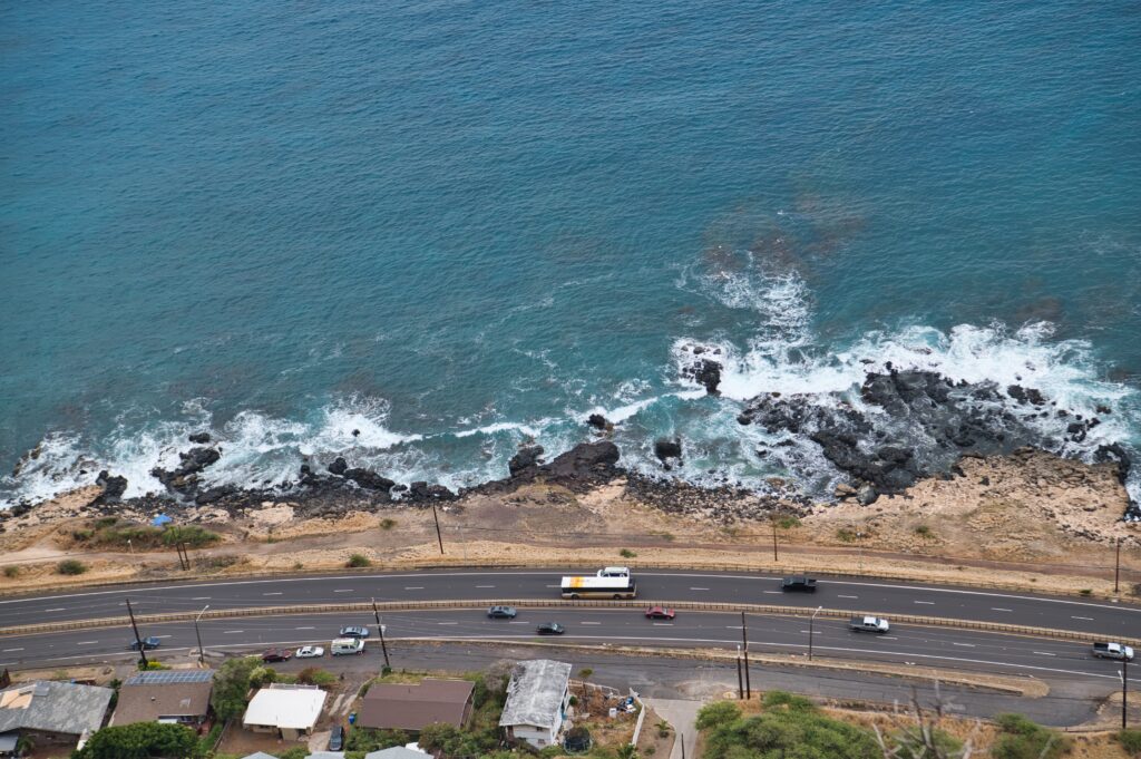
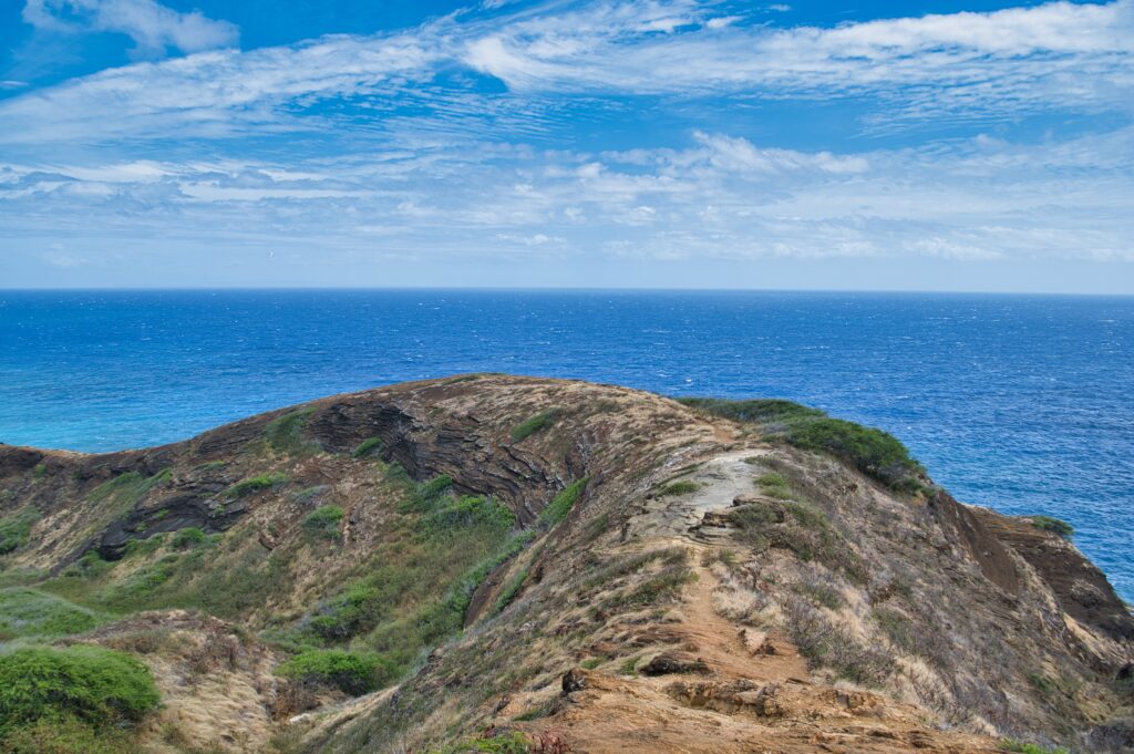
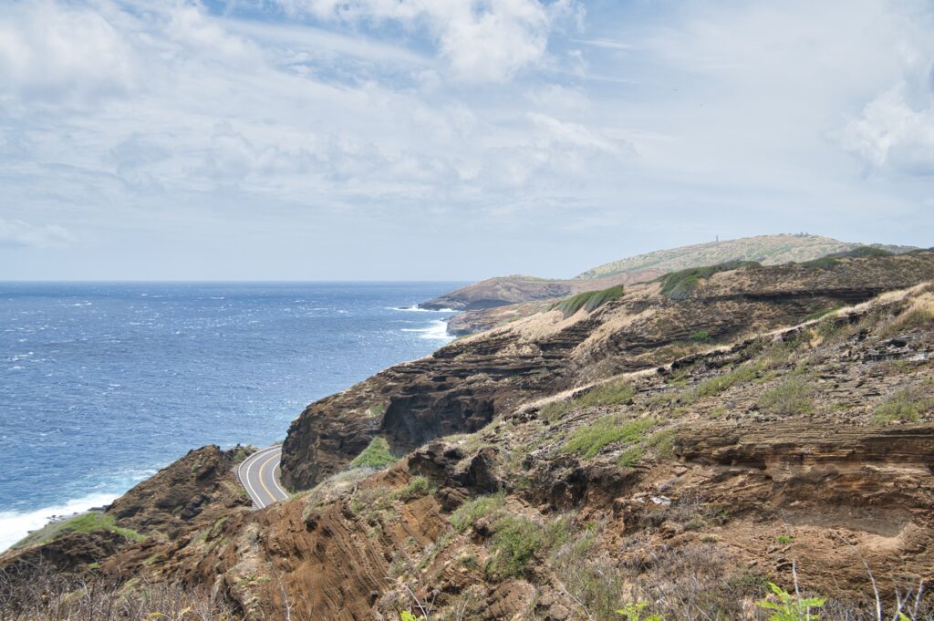
Koko crater arch is on the ocean side of koko crater (the crater hike with the famous railway “stairs” I attempted). You park at the Halona blow hole parking lot, walk the shoulder of a decently busy road, and then veer to the right up the crater. This is looking back at the path we just took.
Just beautiful coastal scenery looking up toward Haunama Bay.
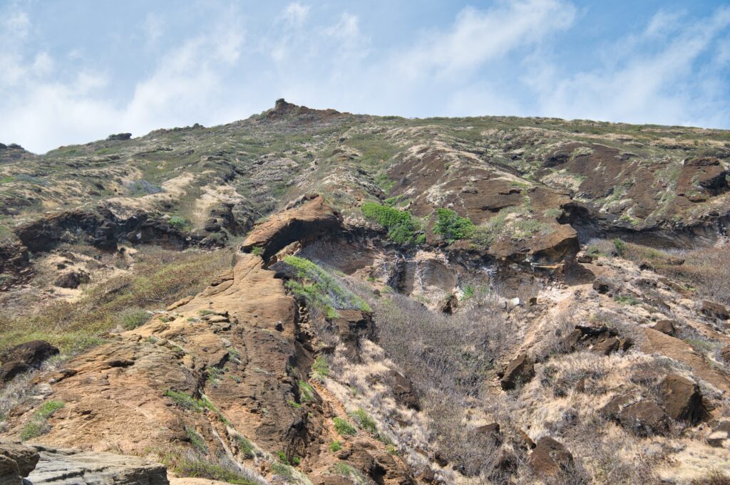
It has been pretty windy lately, so I didn’t make it much further than this to the arch. That face gets really steep. I’d do it on a less windy day, but really I got a picture of the arch and some scenery so I didn’t feel I needed to. People like to get pictures under and on top of the arch.
To the left of Jess you can see a rope people use to get on top. She investigated inside a bit and said there was a steep drop.
I don’t think you could see this arch from the road, so it was pretty cool to “discover” it even if it was a short hike. Altogether it was a mile and 326ft elevation.
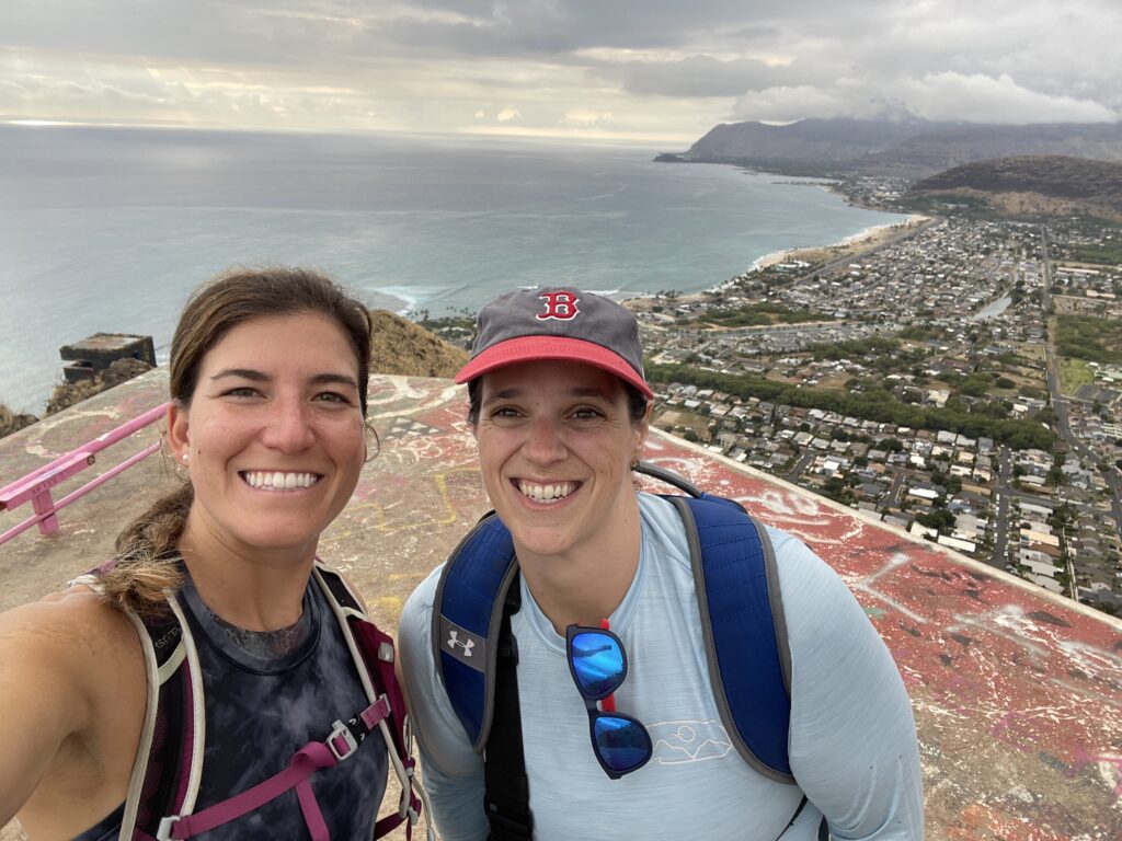
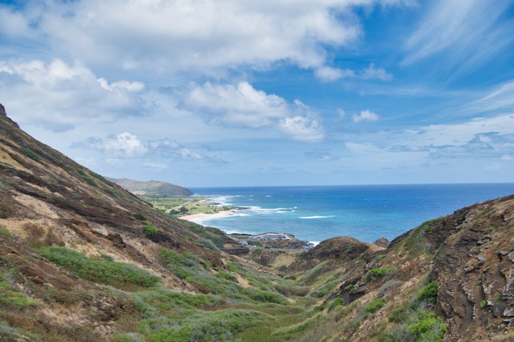
Here’s one image from our trespassing hike. This is looking back toward koko and Hawaii Kai… the goal was to get to a platform to look over toward Waimanalo, our side of the island. Oh well.
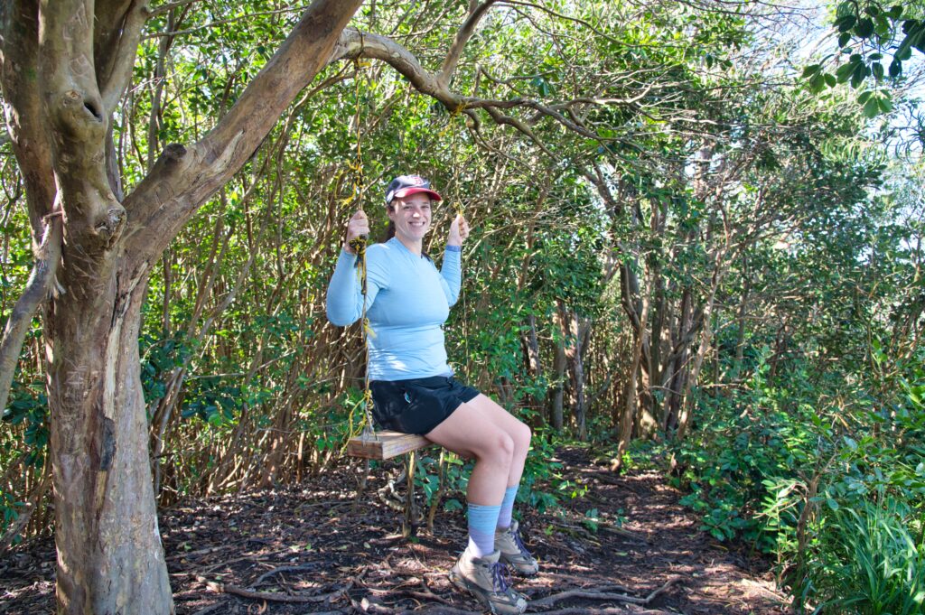
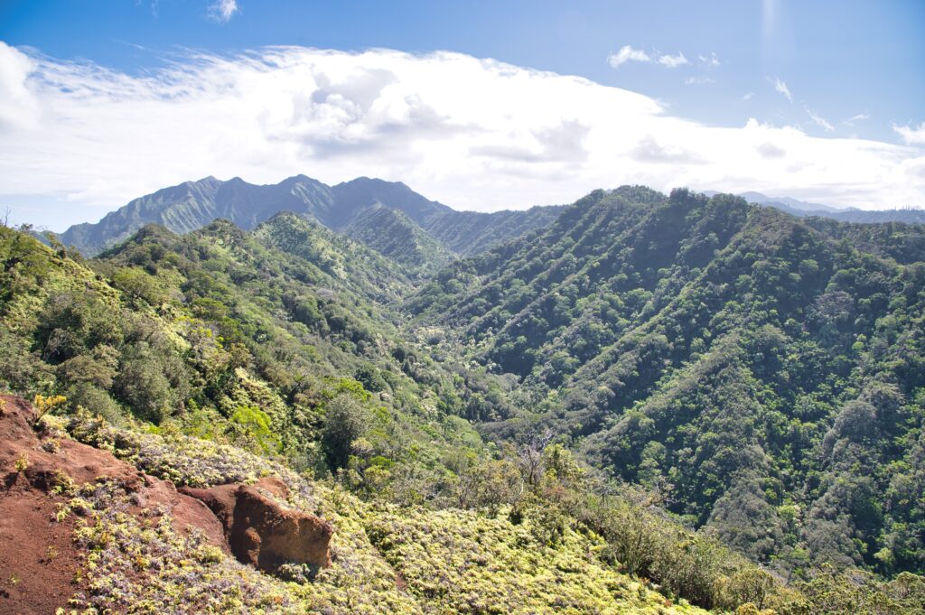
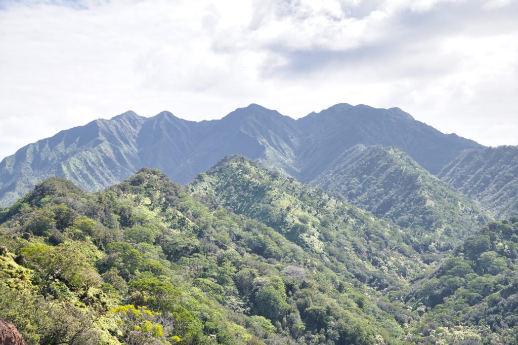
On Saturday I did another KOSC hike. Only one person showed with her husband… I’m getting a little frustrated by lack of attendance. All the same, I LOVED the hike! It’s paved the first mile or so and decently steep. You work your way through a thick tree mangrove and get to the swing about 1.8 miles in.
After climbing and another three tenths of a mile or so there’s a clearing with a view into a beautiful valley.
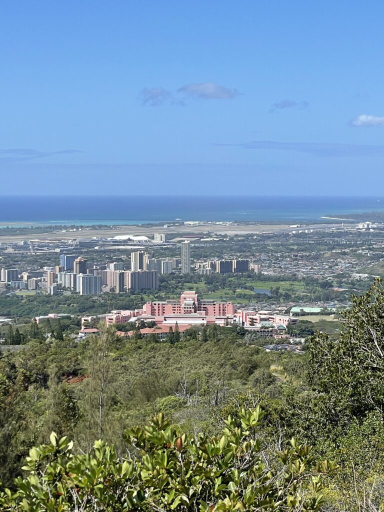
This hike is only accessible through a small base that has a military hospital called Tripler. This means less hikers and plenty of parking without worry of being broken into. Here’s a photo of the pink hospital.
We went just over two miles in, but the elevation was 950ft. It made for a short and sweet climb. The wind was nice but borderline gusty at times and I wouldn’t have wanted to do any ridge walking (thankfully we didn’t need to)